
NASA–SpaceX Launch Sentinel-6B to Boost Global Ocean Monitoring and Climate Forecasting
Vandenberg Space Force Base, California:NASA and its European partners have successfully launched Sentinel-6B, a next-generation Earth-observing satellite designed to sharpen global sea-level measurements and strengthen...
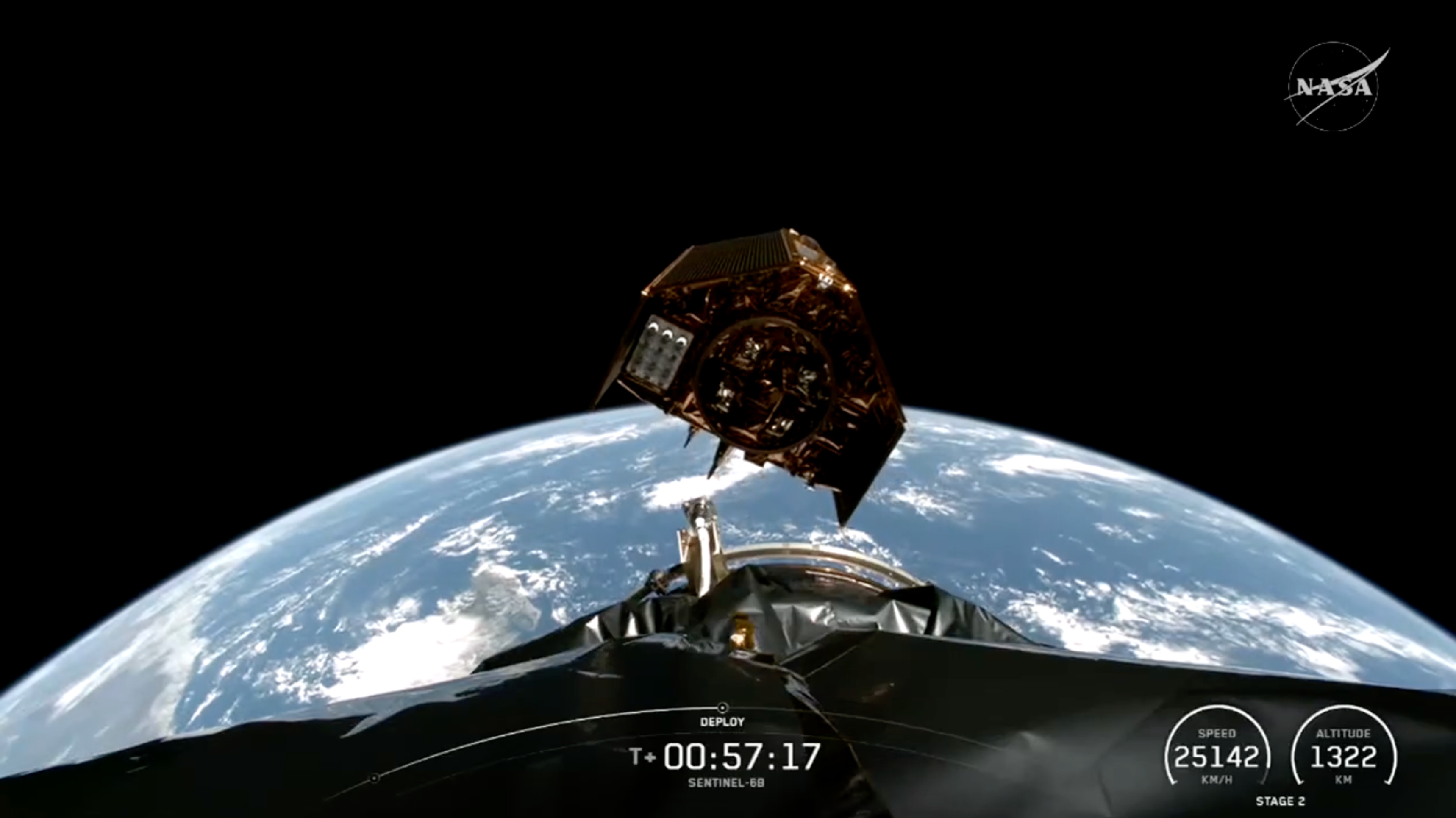
Vandenberg Space Force Base, California:
NASA and its European partners have successfully launched Sentinel-6B, a next-generation Earth-observing satellite designed to sharpen global sea-level measurements and strengthen forecasting models crucial for tracking extreme weather. The spacecraft lifted off aboard a SpaceX Falcon 9 rocket at 9:21 p.m. PST on November 16, marking a major step forward in a decades-long international effort to monitor the planet’s oceans with greater precision.
Sentinel-6B made initial contact with a ground station in northern Canada approximately 90 minutes after launch, with NASA confirming that all systems are functioning as expected.
A Mission Built for Rising Oceans and Stronger Storms
Sea levels are rising faster than at any point in modern history, and coastal regions worldwide depend on accurate data to prepare for flooding, storm surges, and climate-driven changes. Sentinel-6B will measure sea surface height with centimeter-level accuracy from an altitude of 1,336 kilometers, completing roughly 13 Earth orbits each day.
The new satellite will eventually replace its nearly identical predecessor, Sentinel-6 Michael Freilich, launched in 2020. Together, the two form the Sentinel-6/Jason-CS mission, continuing a 30-year record of satellite-based ocean altimetry used by scientists, disaster agencies, and maritime operators.
NASA officials emphasized that precise monitoring of sea levels is no longer optional — it directly influences national security planning, infrastructure investment, and emergency readiness. According to NASA’s Science Mission Directorate, understanding subtle changes in ocean height helps improve forecasts for hurricanes and coastal flooding, and even informs safe splashdown planning for astronaut missions.
How Sentinel-6B Strengthens Ocean and Weather Forecasts
Beyond sea-level tracking, Sentinel-6B carries advanced instruments to measure:
-
Wind speeds and wave heights, key for marine weather analysis
-
Atmospheric temperature and humidity, which shape global weather patterns
-
Ocean heat content, derived indirectly from sea surface height
Because warmer water expands, scientists can identify regions of ocean warming based on small changes in elevation. That information is vital for predicting the intensity of tropical cyclones and understanding how major currents, such as the Gulf Stream, interact with surrounding waters.
Experts say this data can meaningfully impact shipping routes, offshore energy operations, fisheries, naval planning, and insurance risk models.
A Broad International Partnership
Sentinel-6B is the product of a collaborative network involving:
-
NASA
-
ESA (European Space Agency)
-
EUMETSAT
-
NOAA (National Oceanic and Atmospheric Administration)
-
European Commission’s Copernicus Program
-
France’s CNES, which provided technical expertise
NASA’s Jet Propulsion Laboratory contributed three major scientific instruments, while SpaceX provided the launch services. Officials across agencies described the mission as a prime example of scientific cooperation serving global interests.
ESA leaders noted that Sentinel-6B continues a legacy of shared climate monitoring, proving what multinational partnerships can achieve when facing global environmental challenges.
What Happens Next
For the first phase of the mission, Sentinel-6B will fly approximately 30 seconds behind Sentinel-6 Michael Freilich to cross-calibrate measurements. Once the calibration is complete, the older satellite will move to a new orbit, and Sentinel-6B will officially take over as the world’s primary reference for sea-level measurements.
Scientists expect the mission to deliver data for at least five years, adding to the long-term climate records that governments and researchers rely on to track global warming.
Social Media Summary (2–3 sentences)
NASA and SpaceX have launched Sentinel-6B, a U.S.–European satellite that will vastly improve global sea-level and ocean monitoring. The mission strengthens climate forecasting, enhances hurricane predictions, and extends a 30-year international effort to track changes in Earth’s oceans with unmatched precision.