
India's Firm Stance at UN: Map Tampering Will Not Be Tolerated
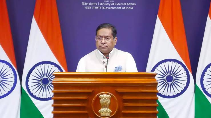
India warned the UN against any external interference or arbitrary changes to its territorial boundaries and maps.
द क्लिफ न्यूज़ डेस्क | राज बढ्खाने
India Delivers Unambiguous Message at the UN: Map Tampering Will Not Be Tolerated
The Cliff News | New Delhi | September 7, 2026
From the platform of the United Nations General Assembly, India has sent a strong message to the global community regarding the protection of its territorial sovereignty and borders. Despite voting in favour of a resolution aimed at promoting accurate and proportionally scaled global maps, India has unequivocally clarified its position on its borders.
New Delhi explicitly warned on the global stage that its support is confined solely to scientific cartography and the technical principles of cartography. This support has no bearing whatsoever on India's territorial integrity or the definition of its borders.
Indian representatives clarified at the UN that this technical endorsement should not be interpreted as India accepting any form of external interference or any arbitrary changes in the depiction of its borders. India will absolutely not tolerate arbitrary maps prepared by any third party or through any means that disrespect India's sovereignty, especially concerning its territorial integrity.
The country's borders and sovereignty are paramount, and any manipulation or distortion in their depiction is unacceptable. India emphasized that maps should aim to provide accurate geographical representation, not to question a nation's claims or its sovereignty.
The Dichotomy of Scientific Mapping and Sovereignty
This firm stance reflects India's well-considered policy of standing with global scientific standards and technical advancements, while simultaneously being absolutely unwilling to compromise on its national security, territorial integrity, and geographical boundaries.
India's assertiveness on international forums demonstrates its complete awareness of the sensitivity of its borders and its commitment to opposing any effort that could undermine its sovereignty.
India believes that the mapping process must be fair and factual, and it should not infringe upon any nation's jurisdiction.
A Clear Message for the Future
India's message is clear to all countries and international bodies contemplating any action concerning maps in the future. Respect for the integrity of its borders is mandatory in the process of improving global maps.
India has made it clear that any disputed, arbitrary, or factually incorrect maps in the future will be completely rejected by India. This step is crucial not only for upholding the core tenets of national security and sovereignty but also for maintaining the principles of international law and respect.
For India, its borders are not merely geographical lines but an integral part of its national identity and security, and they must remain protected from any form of unwarranted interference or tampering.